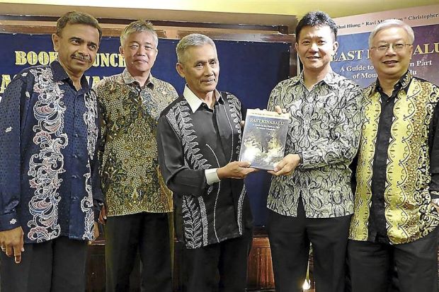
New book explores the other face of Mount Kinabalu
KOTA KINABALU, Oct 30: A seldom seen face of Sabah’s iconic Mount Kinabalu is now documented in a book which traces a track rarely used to the summit from its eastern side.
While every year some 50,000 people hike up the mountain – reputedly the highest in South-East Asia – this is usually via the usual Summit Trail on the western side.
However, only 20 people have scaled Mount Kinabalu through its other face, said Dr Ravi Mandalam, co-author of A Guide to the Eastern Part of Mount Kinabalu.
He wrote the book together with another medical specialist, Prof Chin Shui Hiung, and senior lawyer Christopher Chin.
It is the first guidebook detailing the eastern portion of the mountain which is separated from the western face by Low’s Gully.
The 160-page book was launched on Monday by Sabah Parks chairman Tengku Datuk Zainal Adlin, a pioneer climber of east Kinabalu who was responsible for Operation Raleigh which helped instal aluminium ladders to the steep cliff faces leading to the eastern plateau.
Dr Ravi, who has been up to Mount Kinabalu at least 30 times, said those who scaled it via the eastern face would get to experience a new dimension of the mountain.
“There are vast areas of rocky wilderness, a huge dome-shaped plateau surrounded by peaks, spires and pinnacles and two long mountain ridges that make east Kinabalu much larger than the western side of the mountain.”
British geologist Dr Myles Bowen was among the first climbers to scale up the eastern part of Mount Kinabalu in 1957.
Dr Ravi said he and his co-authors embarked on a series of expeditions over several years to collect information on all known access routes and trails to the eastern part of the mountain.
“We were aided by experienced Sabah Parks staff including ranger Martin Moguring,” Dr Ravi said, adding that the book provided details of four routes on the eastern side namely Bowen’s Trail, Panataran or Bulangga Trail, Kotal Trail and the East Ridge Trail.
source: The Star


